Focusing agricultural conservation where the land needs it most
By T. Burke Parham, M.S. graduate student, Department of Biological Systems Engineering
With support from a CSANR BIOAg grant, Burke Parham is using erosion models to guide targeted conservation that protects soil while minimizing risk for farmers.
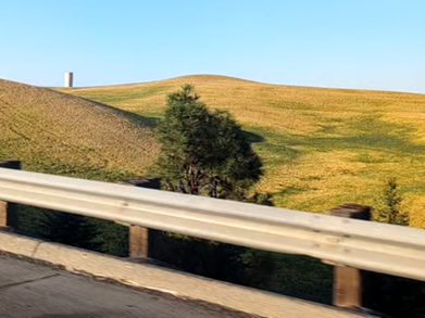
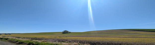
Eastern Washington’s rolling wheat fields are among the most productive dryland cropping systems in the United States. Whitman County alone consistently ranks in the nation’s top three wheat-producing counties. Washington wheat feeds not only the nation, but the world, with much of what is produced here in the Palouse being shipped down the Columbia River, across the Pacific, and around the globe.
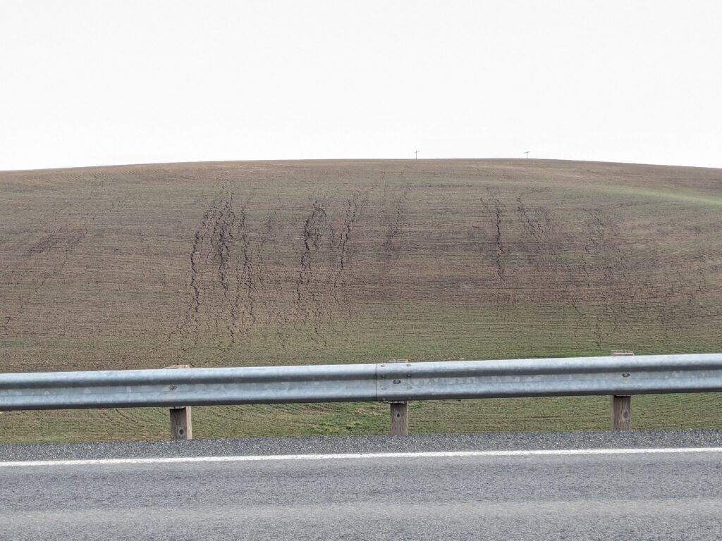
Despite the region’s productivity, signs of soil degradation are visible across the landscape. Some slopes feature streaks of bare soil and small gullies cutting through the land. These are signs of water erosion—the process of topsoil being carried away by flowing water from rain or melting snow.
Beyond human impacts, the soil that washes off these fields ultimately must go somewhere, which is all too often our lakes and rivers. As it makes its way downstream, this sediment and agricultural byproduct degrade water quality and damage fragile aquatic and riparian ecosystems.
Erosion has been, and continues to be, a known issue in agriculture. Its severity is exacerbated by traditional practices such as conventional tillage. In the Palouse region, the unique combination of deep silt-loam soils, rolling hills, and wet winters provides an ideal environment for dryland crop production, but also ideal conditions for extreme erosion.
Since the 1980s, conservation practices have been used throughout the region and the world. Practices like no-till, reduced tillage, contour farming, and cover crops have reduced soil erosion, but adopting these practices can be challenging for farmers. Purchasing new equipment can be risky for operations with high overhead, and changing management strategy with new practices may impact yields. Incentive programs meant to offset some of these costs exist on multiple government levels in Washington, but they can easily be spread thin and do not always work as intended.
But what if these conservation efforts and incentive programs could be focused where they are most needed? Erosion is not evenly distributed across a field or watershed. A small fraction of the land, or “hotspots,” often accounts for much of the soil loss, and the factors that go into the creation of these hotspots are known and predictable. Directing incentive program funds to targeted areas could reduce erosion, while also lowering the burden on the farmer.
Our project, funded in 2024 by the CSANR BIOAg program, estimates soil loss across agricultural watersheds in Eastern Washington via the Water Erosion Prediction Project (WEPP) model. We map patterns of erosion, identify hotspots, and quantify the benefits of targeting those hotspots with conservation practices.
The presence and severity of hotspots depend heavily on how the land is being used and the management of that land. Figure 3 shows an example of just how impactful changing management practices can be, and how hotspots can be located.
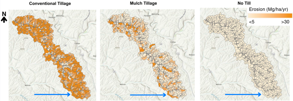
As the model results show, the landscape does not respond to management changes in a uniform way. Some slopes are naturally more vulnerable to erosion due to their steepness or position within the watershed, while others remain stable even under more intensive tillage.
This contrast is what makes the concept of hotspots so important. A relatively small portion of the land can generate a large share of the total sediment leaving a watershed.
Identifying hotspots allows growers and conservationists to focus their efforts where they will have the greatest impact. In many places, reduced tillage may be enough to substantially lower erosion risk. In others, practices like no-till or additional structural measures may be necessary to protect the most vulnerable slopes.
This project is working to translate these insights into actionable guidance for growers in Eastern Washington. By pairing the predictive capabilities of WEPP with local management knowledge, we aim to help producers make decisions that can protect their soil while also avoiding unnecessary costs, disruptions to productivity, or harm to the surrounding ecosystem.
Looking out over the rolling hills of wheat in the Palouse, it is easy to take the abundance for granted. In a region where agriculture is deeply tied to both livelihood and identity, even modest improvements in soil conservation can have lasting effects. Protecting topsoil supports long-term productivity, farm profitability, and water quality. This work reminds us that the resilience of this landscape depends on careful stewardship, and that targeted conservation can help ensure these fields remain productive for generations to come.