Machine learning and field observations improve tillage maps across diverse eastern Washington cropping systems.
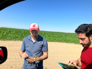
This BIOAg blog post describes how researchers combined satellite imagery, machine learning, and roadside field observations to map tillage practices across eastern Washington. Existing approaches developed for the Midwest performed poorly because crop residue does not indicate tillage consistently across the region’s diverse cropping systems. Using 577 field observations and a framework that accounted for crop type, researchers increased median overall accuracy from 69% to 84%. Accuracy for legumes increased from 34% to 76%. Collaboration with Extension specialists and conservation district staff helped improve the maps and move them into practical use, including work supporting the Voluntary Stewardship Program. Subsequent research quantified uncertainty for individual fields, explored uncertainty-guided data collection, and examined how residue type and age affect satellite measurements. The team plans to use the maps in erosion and soil-carbon models and expand the approach to other dryland agricultural areas.
This publication is part of an archive and may not meet current digital accessibility standards. CSANR is working to improve digital accessibility of all materials. If you need this content in an alternative format, please contact csanr@wsu.edu.
Authors
Norouzi Kandelati, A.
Related Products
- Deploying Satellite-Imagery Based Machine-Learning Models for Large-Scale Mapping of Tillage Practices: Final Report
- Deploying Satellite-Imagery Based Machine-Learning Models for Large-Scale Mapping of Tillage Practices: Progress Report
- Agricultural Data: Big or Small?
Related Project
Year Published
2026
Areas of Focus
Agricultural Practices and Agricultural Technology
Topics
Production Systems and Soils & Fertility
Collaborators
- Palouse Conservation District